Salurn – Lago Santo | W132
The Lago Santo with
crystal-clear water
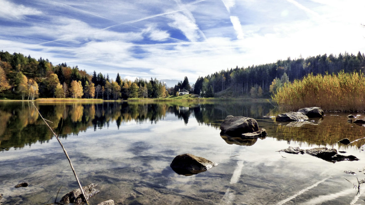
The lake lies on the heights between the Adige Valley and the Cembra Valley, already a little outside the South Tyrolean border in Trentino. A wide belt of reeds surrounds the lake with its crystal-clear waters; the mountains of the Fiemme Valley rise in the background.
The hike begins in the southernmost village in South Tyrol: from the church square in Salorno. Briefly on the road in the direction of Buchholz, then turn right, following M 1 to Buchholzer Street, now continue on this road for a while, passing by farmsteads to the highest, the Maierhofer- or Maroferhof (684 m); from there through mixed woods to the Sauch Hut on the edge of a grass island (946 m; guest house; from Salorno 2:30 hrs.) and on Trail 1 through the woods, climbing to the lake (1195 m). The descent follows the ascent path. You can also turn left after Sauch and descend on trail 409 through the Salomon and Notdurfter farms; this trail is somewhat shorter than the other.
Challenging hike with over 1,000 meters of elevation gain
Through mixed forests to the mountain lake
Excursion across the language border
Starting point: Church Square in Salorno
Pit stop: Sauch Refuge, Holy Lake Refuge
GPX-Track -km, -m GPX
| Name: | No data |
| Distance: | No data |
| Minimum elevation: | No data |
| Maximum elevation: | No data |
| Elevation gain: | No data |
| Elevation loss: | No data |
| Duration: | No data |