Geisler Alm | W312
These mountain peaks are a must see
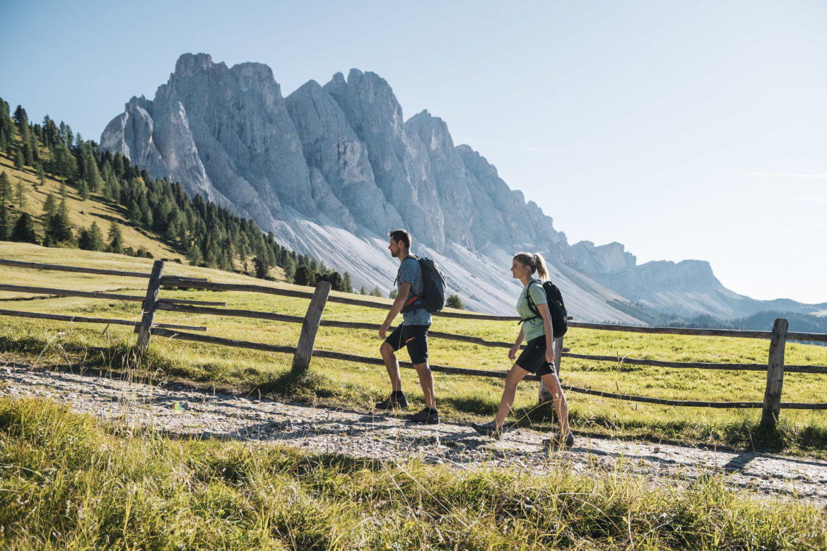
Your hike starts in Ranui/Villnöss. From Ranui on the forest road parallel to the Villnöss stream on trail no. 33 into the valley. In two loops gently ascending to the Zanser Alm (1680 m) and over the road bridge on trail no. 32 along the St.-Zenon-Bach. You come across the “Adolf-Munkel-Weg” and hike along it in a westerly direction. It runs close to the timberline, crossing several ridges. Mighty Swiss stone pines and alpine rose fields line the promenade, the views of the north walls of the Geisler peaks are fascinating. Turn right and follow trail no. 36 down to the popular Geisleralm. From here back on the “Munkel-Weg” and continue to the right. Via trail no. 28 down to the valley floor and out on the forest road to the Ranui parking lot.
Great looping hike from Ranui via the Adolf Munkel trail to Geisleralm
Unique mountain scenery from the sun terrace and the Knottnkino of the Alm
Excellent cuisine at the Geisleralm
Starting point: St. Magdalena in Villnöss
Pit stop: Geisler Alm
GPX-Track -km, -m GPX
| Name: | No data |
| Distance: | No data |
| Minimum elevation: | No data |
| Maximum elevation: | No data |
| Elevation gain: | No data |
| Elevation loss: | No data |
| Duration: | No data |