To the Penegal | W107
360° views from the Penegal
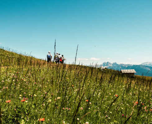
The start of the hike is on the Mendelpass. You can either go up with the Mendelbahn and save yourself the steep climb or if you want to really push yourself, then you start from the valley station via the Mendelsteig (also called Telefonsteig) to the pass. From the Mendel pass, a hiking trail leads up to the Penegal. Throughout the hike there are beautiful viewpoints to Kaltern and Lake Kaltern.
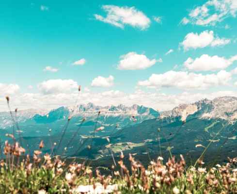
After the summit of the “Small Penegal”, the trail leads you along the edge of the mountain to a secondary elevation of the Penegal, where the summit cross is located. A large table with a bench offers the ideal place for a picnic. It is really idyllic here. Your view sweeps from the Rittnerhorn over Bozen and the western Dolomites in the north, over the Überetsch, the southern Dolomites to Lake Kaltern.
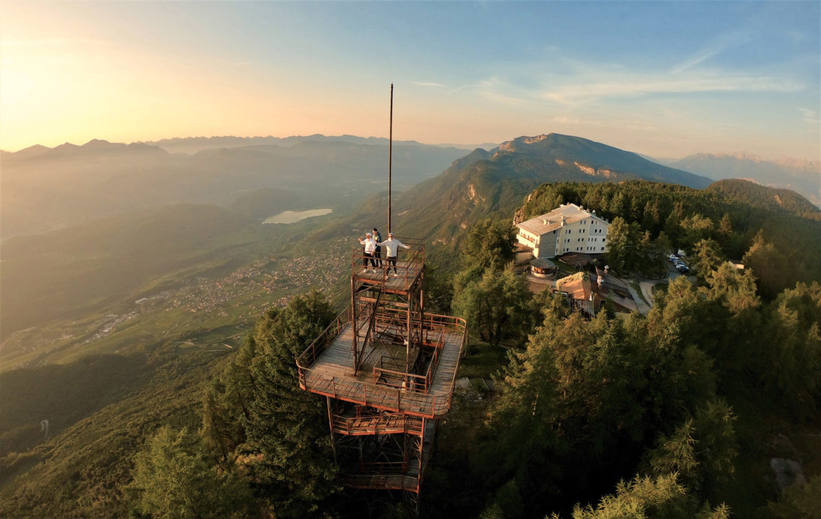
After your pit stop, you will continue to the real Penegal peak, where the Penegal Hotel is located. You can stop for a break and sit on the sun terrace. From here you can see as far as the Ortler group in the west. Not far from the hotel is the well-known lookout tower. Unfortunately, the lookout tower is closed due to construction work.
You can return to the Mendel Pass either via the road with little traffic or via the outward route.
Many beautiful viewpoints
Really pleasant when it gets too hot in the valley in summer
Those who have not had enough at Penegal can continue to the Regole meadows
Starting point: Mendelpass
Pit stop: Hotel Penegal, Enzianhütte
GPX-Track -km, -m GPX
| Name: | No data |
| Distance: | No data |
| Minimum elevation: | No data |
| Maximum elevation: | No data |
| Elevation gain: | No data |
| Elevation loss: | No data |
| Duration: | No data |